Quarries, rubbish dumps, junk yards and protected natural space: the multiple transformations of Mile End East
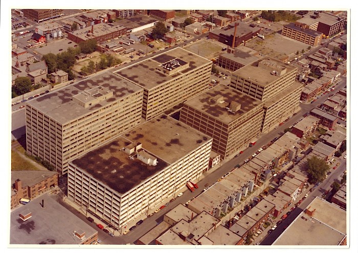
Today, northeastern Mile End—also known as the Saint-Viateur Est sector—is best known for its large concrete buildings, dubbed megastructures, and its protected natural space, the Champ des Possibles. Until very recently, little was known about the history of this area, other than its past links to the railroad. From stone quarries converted into dumps and ponds, to the huge scrap yards of the mid-twentieth century (a source of complaint from the neighbours), to a landmark avant-garde play, come learn what our recent research on the neighborhood’s history has uncovered. Many surprises await you!
Inscrivez-vous
À savoir sur cette promenade
-
 4 mai
4 mai
-
 13h00
13h00
-
 2h
2h
-
 Anglais
-

- 77 rue Bernard Est
- Montréal
- H2T 1A4
- Autobus 55 Saint-Laurent, arrêt Bernard
-
 Le Plateau-Mont-Royal
-

- Bienvenue aux chiens (en laisse)
-

- Communauté
- Nature et agriculture urbaine
- Architecture et patrimoine
- Histoire
-
 Mémoire du Mile End / Mile End Memories
-
 https://memoire.mile-end.qc.ca/en/
Inscription
La promenade est terminée!